Liz Bonnin introduces a video clip exploring the impact of flooding on the Somerset Levels in the UK.
Video
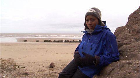
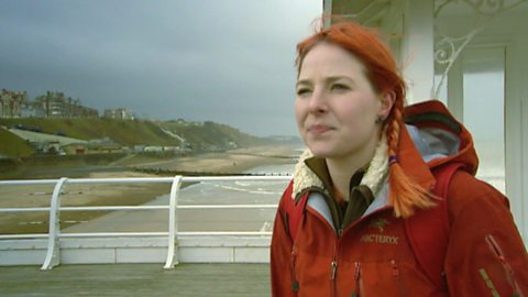
LIZ BONNIN: Hi I’m Liz Bonnin. We’re looking at physical geography. And on such a glorious day like this here at Seven Sisters on the south coast of England, it’s hard to imagine it raining so much that the rivers burst their banks and flood your home town.
But that’s exactly what happened in Somerset back in 2014. In what were the worst floods for over 100 years. Amongst the causes were things that you’ll study in your geography lessons. Lots of rainfall, obviously, and a lack of dredging, which means managing the rivers - unblocking our waterways so that they’re clear and wide enough for water to keep flowing.
Now in this clip we find Matt Baker and Tom Heap going back to the affected areas a year after the floods, to see how people were recovering and to find out what was being done to make sure it wouldn’t happen again…
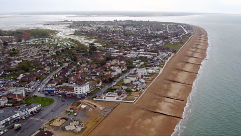
MATT BAKER: Somerset. An ancient, agricultural country. A landscape defined by its geology. From Cheddar Gorge, to the slate and sandstone of the Quantocks.
But it’s the beautiful low lying Somerset Levels that have gained the most attention in recent years. But sadly for all the wrong reasons…
NEWS REPORTER: Torrential rain and 70 mile an hour winds dumped tonnes of extra water on a landscape that’s already sodden.
MATT BAKER: The water swept the villages to the east of Taunton. Today, I’m in Burrowbridge to see what’s happened since. I’m revisiting Jeff Miller. A farmer who’s land was ruined by the devastating effect of the water.
The last time I was here, Jeff had moved all of his cattle away from his flooded farm. He was left guarding his home with a ring of round bales that went all the way around the farm house.
Totally cut off, the only way in was on foot. And I brought some much needed supplies.
FLASHBACK: There’s your groceries.
JEFF: Thank you very much indeed, that’s ideal. Thank you.
MATT BAKER: Pair of size nine -
JEFF: They’re very much in demand and very welcome at this stage.
MATT BAKER: Now then, Jeff. How you doing?
JEFF: Hello, Matt. Good to see you again.
MATT BAKER: Good to see you. What a difference!
JEFF: Yes. Yes.
MATT BAKER: Are those the same wellies?
JEFF: Those are the wellies you brought from the pub for me Matt, thank you very much indeed. They’ve done me well.
MATT BAKER: Good lad. Excellent Well, listen, I honestly can’t believe the difference.
JEFF: No, in fact, you know, come and have a look, we’ve made some big improvements.
MATT BAKER: Jeff’s land was under water for three months. It had a huge impact on the farm’s income.
JEFF: Had we not had the floods, I would have taken three cuts of grass off of this at least. 35 acres about 10 bales an acre it would have been about 1000 bales of silage. I have lost a years’ production.
MATT BAKER: And it’s not just producing the feed for the winter’s time I mean, grass really is the key to your business, isn’t it?
JEFF: It is. Because I produce, you know, I’ve got a suckler cow herd. And so beef is the main enterprise and if I can produce as much of that as possible from grassland it keeps my cost down. It means I’m not going out buying expensive concentrates and if I feed better quality grass, I’ll get better quality meat.
MATT BAKER: What a remarkable job you’ve done here. I mean look at this luscious green field. I mean this is a field of grass that any farmer would be proud of.
JEFF: Initially, we had to go through with a subsoiler and let, you know, let some air into the soil. And having put the grass seed in up it came, and then we had to put this special soil conditioners etc to get it working correctly.
MATT BAKER: Things may be getting back to normal on Jeff’s farm. But what about on the rest of the levels? Tom’s been finding out.
TOM HEAP: Somerset was by no means the only part of the UK to suffer from last winter’s floods, but it was under water for the longest.
TOM HEAP: FLASHBACK: What are you hoping to be able to see or do today?
NEIL CRADDOCK: I’d like to think that the water would all disappear but obviously that ain’t going to happen at all. So, I think we’re just going to see a very sad scene.
TOM HEAP: Last February local businessman Neil Craddock’s warehouse was only accessible by boat. He faced losing his livelihood.
FLASHBACK: So we’re going into the first floor of the building, are we?
NEIL CRADDOCK: Into the first floor where it’s the only dry part left.
TOM HEAP: Yeah, so everything down here is…
NEIL CRADDOCK: Everything below there is under water.
TOM HEAP: Can you survive?
NEIL CRADDOCK: We’ll, we’ll have to rebuild.
TOM HEAP: And rebuild is exactly what Neil did. Using his own money, and with the support of his staff and clients, he was back in his factory by April.
How long and how difficult was it for you to get back to this?
NEIL CRADDOCK: Very, very difficult indeed.
TOM HEAP: Yeah.
NEIL CRADDOCK: I mean we had to physically strip the factory go to another factory, rebuild what parts we could, scrap what we couldn’t, then come back here, rebuild the factory, wire it and get producing again.
TOM HEAP: How much did it cost you?
NEIL CRADDOCK: I really don’t know off hand. It’s a huge amount of money but should think I’ve had to put a quarter of a million pounds into it. Just to get ourselves up and going.
TOM HEAP: What does that mean to you?
NEIL CRADDOCK: Well, effectively my retirement I’ve already spent. So, I’ve got to start earning it again now.
WOMAN: FLASHBACK: Why was this not done ages ago? Why have you only started doing this now?
TOM HEAP: Ian was one of the many who blamed the Somerset floods on local waterways not being dredged and pushed hard to change that. He said that campaign and the media attention that followed yielded real results. Starting last March, around five miles of the two main rivers, the Parrett and Tone, were finally dredged.
NEIL CRADDOCK: I think the contractors have done a brilliant job, personally if you look at the profile of the river now compared to the way it was, there is absolutely no comparison whatsoever. Today’s it’s a proper waterway. Earlier, it was a hardly a stream really. And you can actually see flow of water. It looks like it’s operating probably as a real waterway.
TOM HEAP: So if we have a week of rain and you look at the forecast and there’s another week coming up, will you be confident?
NEIL CRADDOCK: We’re all fairly nervous, Tom. Because of what’s happened previously. But we have had actually a week of rain, you know, a few weeks ago and I’ve seen the way that the river has handled it and I’m really quite confident.
TOM HEAP: The dredging of these rivers was seen as a victory by the locals. And the work didn’t stop there. Temporary pumping sites have been upgraded. Major roadworks have been carried out and there’s also been extensive repairs to defences like flood banks and spillways.
LIZ BONNIN: So as you can see, trying to stop flooding involves a lot of effort, building projects and expense. But those people who were effected in Somerset would definitely agree that it’s all worth it.
Download/print a transcript of the video.
Liz Bonnin introduces a video clip about the 2014 floods in Somerset - the worst for over 100 years.
The floods were caused by high rainfall and exacerbated by a lack of dredging of water courses. Matt Baker and Tom Heep revisit the location one year on from the floods to see what has changed. They revisit a farmer whose land was inundated. The farmer describes the effect of the flood, including loss of income.
Following the flood the local river was dredged and the people of the area believe this has helped. The film considers some of the other measures that have been taken to prevent flooding or to mitigate its effects.
Teacher notes
Download/print the Teacher Notes for this episode (pdf).
Before watching the video
Locate the Somerset Levels on a map of the UK and ask students to write a locational description.
Look at images of the Somerset Levels. Ask students why this area may be prone to flooding. Show students where the Rivers Tone and Parrett are. An OS map may be useful to look at as it will show how low-lying the ground is.
A weather report for the time could also be shown to students to help them to understand the impacts of torrential rain.
Introduce key terms such as:
Dredging: Clearing the river bed by scooping out mud, weeds and rubbish and removing it from the river, deepening the channel.
Agriculture: The science or practice of farming.
Torrential rain: Extremely heavy rainfall.
During the video
You may wish to stop at relevant points during this short film to pose questions and check understanding or wait until the end.
Useful questions might include:
- What happened in 2014?
- What is dredging?
- Which locations were affected by the flooding?
- What were the impacts of the flooding?
- What happened to the farmers?
- How long was some of the land underwater for?
- Why is dredging needed?
- What other solutions were there to the flooding?
- Is it difficult to prevent flooding?
After watching
Discuss with students the impacts of flooding on the Somerset Levels, ask them to categorise the impacts into social, economic and environmental. Students could also rank the impacts of flooding.
Investigate river management strategies such as dredging. Show students images of dredging. Ask them what they believe the advantages and disadvantages of these methods. The class could be split into groups to each investigate a different method of river management, these could then be presented back to the rest of the class.
A case study could then be developed for the Somerset Levels, identifying the cause of flooding, the impacts and the responses. Students could also investigate whether this location has flooded since 2014 and whether the river management strategies had worked.
Where next?
Ask students to investigate another river flood, this could be that is local to your school. Students should divide their research into the causes of flooding, the impacts and the responses.
Students should look at the river management strategies used in that location and how well those strategies work in protecting local people and businesses from flooding.
Curriculum notes
This topic appears in Geography at KS3 (Hydrology) and KS4 / GCSE (Rivers and water) in England, Wales and Northern Ireland and National 4/5 in Scotland.
More videos from this series
What is the water cycle? video
Iain Stewart describes the water cycle including evaporation, condensation and precipitation.
How does a river change as it travels downstream? video
An archive clip of Sir David Attenborough as he follows the course of the Amazon River as it travels downstream.
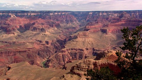
The erosion of the Grand Canyon. video
Liz Bonnin introduces the Grand Canyon - its ancient geology and what can be learned from the erosion of the rocks.
What coastal management techniques are being used on Hayling Island? video
Introduces the coastal management techniques used on Hayling Island in Hampshire to control drift and flooding.
What is a ‘spit’ and how does it form through longshore drift? video
Katie Knapman explains how a spit forms through longshore drift and is a dynamic physical process, constantly changing the coastline.
The geology of the Jurassic Coast. video
Exploring the Jurassic coastline and its geological significance with rocks spanning the Cretaceous, Jurassic and Triassic periods.
How have physical processes impacted the landscape of Yorkshire? video
Julia Bradbury explains the formation of Malham Cove including limestone pavement, highlighting the impact of glaciers on the landscape.
Glaciation and the UK coastline. video
Alice Roberts explains how Britain was once connected to Europe, but changed due to rising sea-levels following the Ice Age.
What evidence is there for climate change in the UK? video
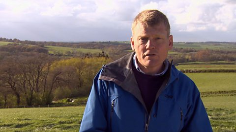
Tom Heap considers the evidence that the UK climate might be changing - with more droughts, higher summer temperatures, but wetter winters.
How can plate tectonics impact oceans? video
Exploring how the plate tectonics impacts the coastline, focusing on California through study of the San Andreas fault.
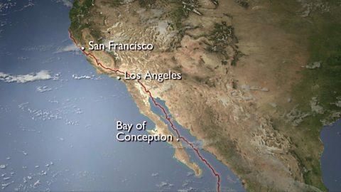
Plate tectonics in the UK - Anglesey. video
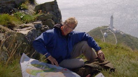
Nick Crane explores the geology and seismology of Anglesey - earthquake hot spot of the UK.
Deforestation and the growth of soya in Paraguay. video
Simon Reeves visits Paraguay to consider the deforestation that has occurred there to grow soy and the challenge of conservation vs development.
How has glaciation shaped the landforms of the Northern Hemisphere? video
Iain Stewart explains the glaciation of the Northern Hemisphere, focusing on the Yosemite Valley in California.